01509 812030
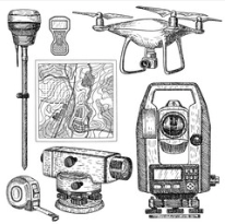
3d SurveyScan have undertaken topographical surveys for a wide variety of market sectors. Using the most up to date survey equipment for all sizes of projects. For the majority of sites we utilise laser scanners, robotic or reflectorless total stations and GPS positioning methods. Combining laser scanning and total station instruments enables us to offer a wide range of both 2d and 3d deliverables. We have on some projects for example, combined the GPS positioned topographical survey, underground utilities tracing and complete Revit model of the existing structures. The scan data can be later interrogated to extract plans, elevations and sections in any position including local topographical information. 3d SurveyScan regularly provide measured building surveys in 2d Autocad format derived from accurate laser scanning and topographical survey techniques.