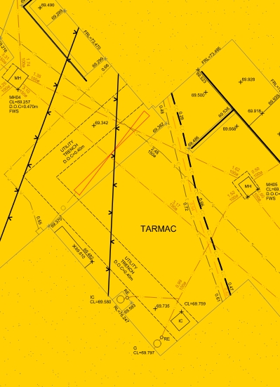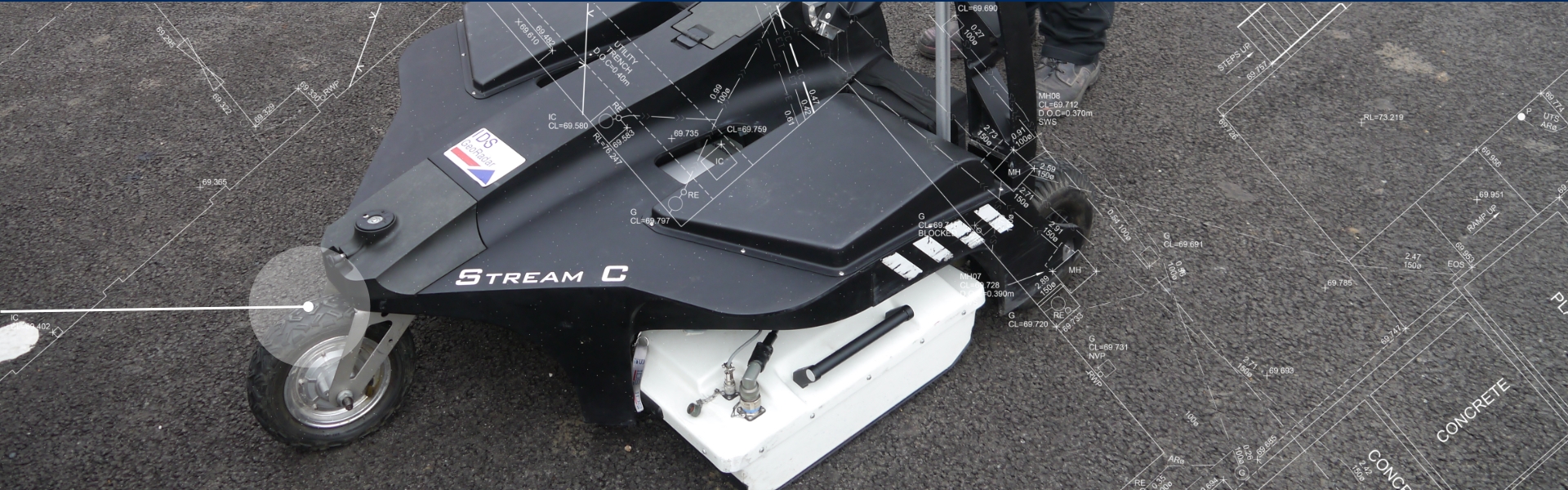
Combining Ground Penetrating Radar (GPR) and conventional utility surveys 3d SurveyScan aim to provide our clients with accurate positional data of below ground services.
GROUND-PENETRATING RADAR (GPR)
A geophysical method that uses radar pulses to image the subsurface. This nondestructive method uses electromagnetic radiation in the microwave band (UHF/VHF frequencies) of the radio spectrum, and detects the reflected signals from subsurface structures.
UNDERGROUND UTILITY SURVEYS
Often the geographic location of utilities such as pipes, cables, ducts, sewers, foul and surface water drainage is recorded on inferior quality maps and in some cases it is not documented at all. The underground utility survey minimises project delays and utility damage – saving delay and damage costs.